Categories
Trail Conditions

Preddy is wet

Hey All, Just an FYI, I road Preddy yesterday and although it did not get the big rains the past few days that other places have, the trails are still in pretty bad shape. And it appears to be getting a fair amount of bike traffic. It seems the hard rains have wash out the trails more and roots and rock exposure is greater in several areas. Clockwise on the loop is mostly wet and muddy around to the entrance of the advanced loop. There are probably 15 to 20 mudholes througout the park, several of which are deep and soupy. Across the creek is by far in the best shape except for a few spots. There are several downed trees throughout the park as well. It’s gonna need some work when it dries out.

Categories
Accomplishments

Making Mountains out of O’Hills

Observatory Hill is a place Thomas Jefferson most certainly used for exercise, relaxation, and recreation. Today, students, faculty, and townspeople use this near-campus oasis likewise.

The Charlottesville Area Mountain Bike Club (CAMBC), has a long history of caring for this much-loved land, but cyclists actively cared for this land even before the club existed. For me, the story starts almost 20 years ago when I first set foot on, what is lovingly referred to as O’Hill …

The sign read “Trails constructed by the UVA Mountain Bike Club” and had a list of rules that needed to be followed. I later learned that UVAMBC was a group of energetic students with little experience and minimal faculty guidance. Later, they merged with the “roadies” and formed the UVA Cycling club, which still exists today.

I never saw the trails that day, as I was too out of breath by the time I got to the top of the hill to wander down the trail. But I darned sure knew I’d be back soon. I have since lost count of how many times I visited, and over time the sign faded until no one could read or even really remember what it all it said, and it eventually fell off its post. Maybe if one looks hard enough, you can still find remnants of it on the ground somewhere near there…

I’ve seen that sign a lot of times since that first day. I remember passing it, completely out of breath as I was on the 3rd lap of “The O’Hill Meltdown”, the race held in the spring by the UVAMBC to raise funds for attending other collegiate races. The race, named after the abandoned nuclear reactor, was notoriously hard as it packed in over 1,000 feet of elevation gain in a six-mile loop. And then you had to do multiple laps to get to the finish line. And a few times a version of the race was held in the fall, too, but renamed to the Grilled Cheese Heave for the collegiate circuit.

For years, Sue G. lead the CAMBC night ride on O’Hill, and we would see that sign at the start every week, all year long. I actually remember reviewing the rules at one of the CAMBC beginner rides, the few times the beginners ventured onto O’Hill. I definitely remember passing the sign on the CAMBC “Mother Nature” ride – the ride held on the coldest day of the year. O’Hill is always the choice to ride when it’s cold, as it’s so aerobically challenging, you can never get cold.

Over the years, all the visits to O’Hill gave me a lot of insight.

Of course, it taught me the need for fitness and exercise. It did that the first time I saw that sign, as it’s still not the top of the hill and I was already long passed my fitness limits. But it also taught me about how to be safe – whether that be group riding etiquette about not leaving people behind, when to walk the bike on dangerous terrain, or when to slow down and share the trail with other trail users.

O’Hill also taught me about the need to be good stewards of the land. Of course, CAMBC helped here with classroom sessions in partnership with IMBA and on-the-ground trail work sessions. I learned about things like how water running down the trails causes erosion, and that leaving the trail can form what I now call “social trails”. Social trails are prone to erosion because they do not follow good design principles.

O’Hill has taught me the need to be actively involved in building relationships. For example, CAMBC and UVA recently formalized their relationship with a memorandum of understanding (M.O.U.) This relationship has yielded some excellent opportunities. First, a master plan for O’Hill to improve safety, usability, and minimize the potential for user-caused erosion. The plan includes addressing variety of issues. One example is addressing a trail placement where the trail had been placed too-close to a dangerous cliff. Another example is rerouting and rehabilitating areas where erosion is out of control, or installing erosion-control features such as grade dips. Further, we are working on better signs and trail markings to help everyone find their way safely back to where they want to be. If you want to help our efforts, watch for upcoming trailwork days at O’Hill.

These days, I spend my efforts trying to share the things I have learned on O’Hill. I organize trail work days to get the word out about how to prevent erosion, so that O’Hill can teach its lessons for generations to come. During these trail work days, besides directly solving erosion issues, we teach these things I’ve mentioned. We start every session with a safety lecture, where we cover how to safely use hand tools and to stay out of people’s “circle of death”. The club is very happy to have such excellent trail work partners these days – the Rivanna Trail Foundation, UVA Cycling, Madison House, Charlottesville Area Trail Runners, the boy/girl scouts, as well as organizations we occasionally work with.

I am not sure what lesson O’Hill will teach me next, but I am sure the wise ole hill will at least remind me once more that there is a reason it is not called “O’Flat.”

Categories
Community

CAMBC All Hands Group Photo!

CAMBC,

Things have come together nicely for the CAMBC All Hands photo!  Remember, it’s Sunday, May 21, 2pm sharp at the Walnut Creek field by the dam and you’re supposed to bring everyone!  That includes your family, your (legally-leashed) trail dog, your grandpa who bought you that first bike at age 5, that weird uncle who helped you learn to ride, your (legally-leashed) trail cat, that guy you met on a ride once, your (legally-leashed) trail fish…. you get the idea.
Here’s a list of cool things that will be happening!
  • I have a huge pile of schwaggy give-aways from both Endeavor Cycles and Blue Ridge Cyclery.  Thanks to both shops for making sure we (camera) roll in style.  First pick at the schwag goes to the person with the best costume!
  • There are women’s, beginner, intermediate and expert rides scheduled.  Rides leave from the UPPER parking area at noon and immediately after the photo.  Thanks to Bobby, Erik, Sam, Ellen, Jip, Shawn!
    • Noon:  Beginners lead by Erik
    • Noon:  Lady’s beginner ride lead by Jip.
    • Noon:  Quick Ride lead by Sam
    • 2:20: Beginners ride lead by Bobby
    • 2:20: Lady’s Intermediate ride by Ellen
    • 2:20: Quick ride lead by Shawn
    • Possible kids rides too — I’d lead, but I can’t keep up with how fast these guys are these days!
  • Pro-quality camera equipment is coming, including a drone for some aerial shots.  Thanks to Drew for getting all the photog stuff dialed!
Also bring anything you need to have a good time:  A picnic, a chair, a legally-allowed beverages, obviously your bike, fishing poles, etc.
Questions, comments, bribes?  let me know!
-j
Categories
Trailwork Reports

New Trail Section at O-Hill. CAMBC and RTF Combined Trail Work Day

cambc_imba_logo http://www.rivannatrails.org/resources/Pictures/RTF_Logo_Green_Round.png?t=1310000976561 UVA

On November 15, 2005, the Charlottesville Area Mountain Bike Club (CAMBC) and the Rivanna Trail Foundation (RTF) tackled a big problem! A dangerous section of trail ran within inches of a cliff, a serious cliff!

C:\Users\jdh8d\Desktop\2015Nov14_Trailwork\IMG_1538.jpg

Yes, that’s the trail surface at the bottom of the picture!

C:\Users\jdh8d\Desktop\2015Nov14_Trailwork\IMG_1539.jpg

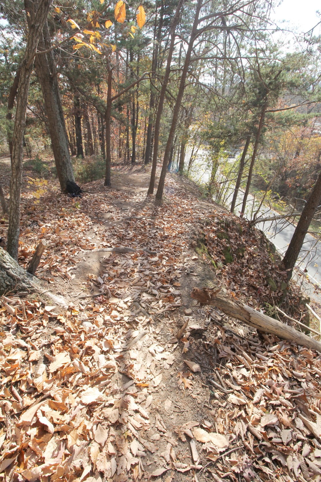
Had anyone gone over the edge, a 100+ foot tumble would have landed them on the highway ramp. It could have been a really bad day for someone. Luckily, no one has been hurt yet.


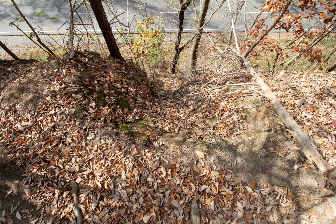
And just as bad, our beloved hill was having an erosion problem just 50 feet down the trail.

C:\Users\jdh8d\Desktop\2015Nov14_Trailwork\IMG_1521.jpg

This trench actually extended almost ¼ mile up the hill. The old trail was a fall line trail – every time it rained, the water simply had no other place to run! Erosion was out of control. Almost 2 foot of soil has washed away from this section of trail already. Corrective action was necessary.

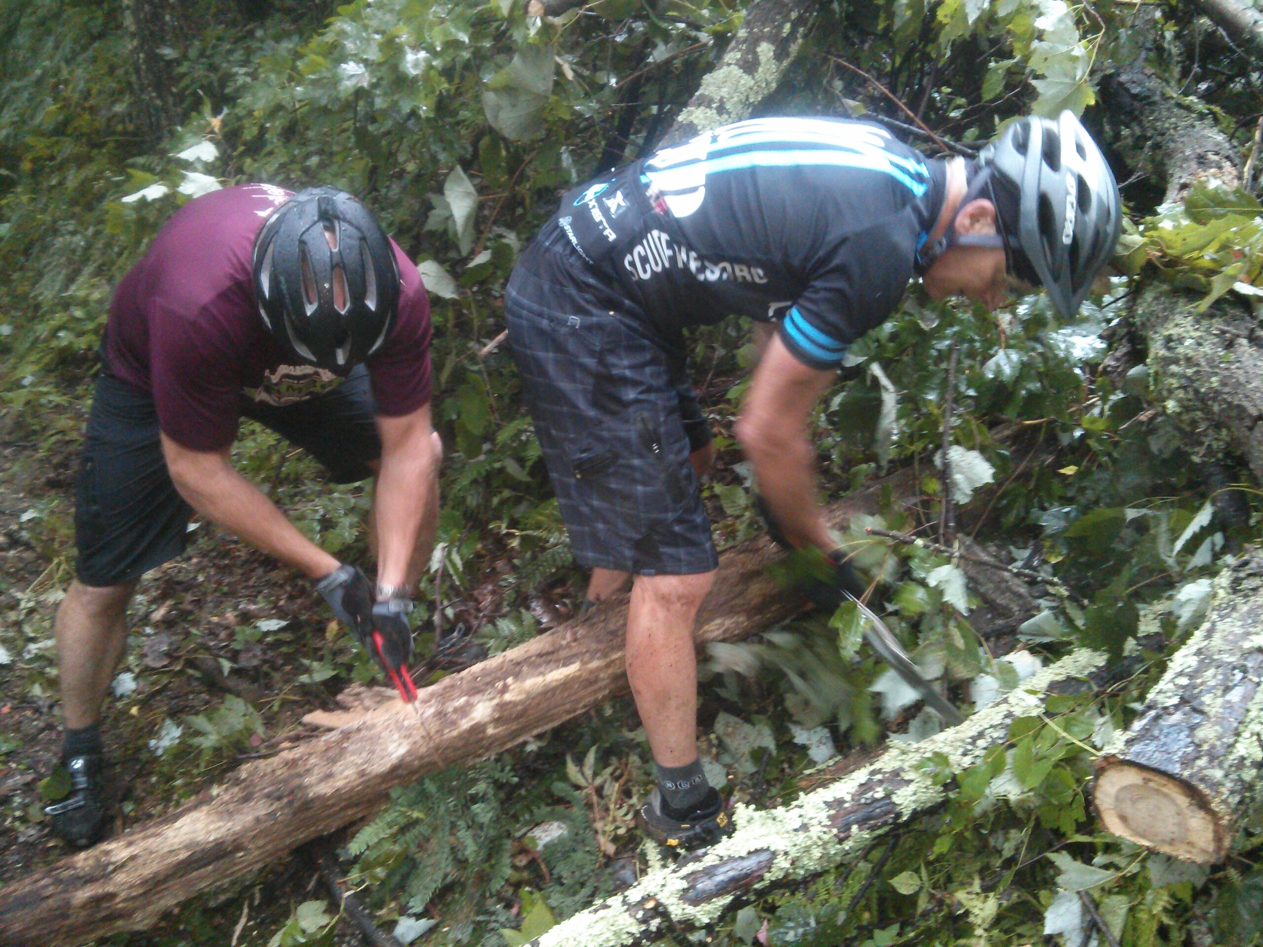
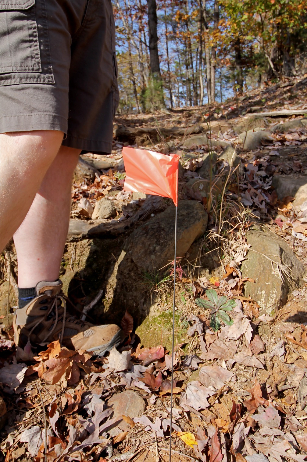
So, UVA, CAMBC and RTF to the rescue! CAMBC and RTF prepared for the trailwork day by spending time scouting the hill side and figuring out the best place to move the trail. The trail had many constraints: it needed to be appealing to users, safe from danger, have a sustainable grade, include appropriate water drainage features, connect users to the other parts of the trail system, and avoid a telecommunications cable. After design, we marked the trail for the volunteers to build on the work day. We also prepped the work site by having a qualified chainsaw operator with proper safety gear remove several trees that had fallen in the path of the planned trail, but no live trees were felled in the building of the trail. This step is important to do before volunteers are in the area for everyone’s safety.

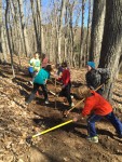
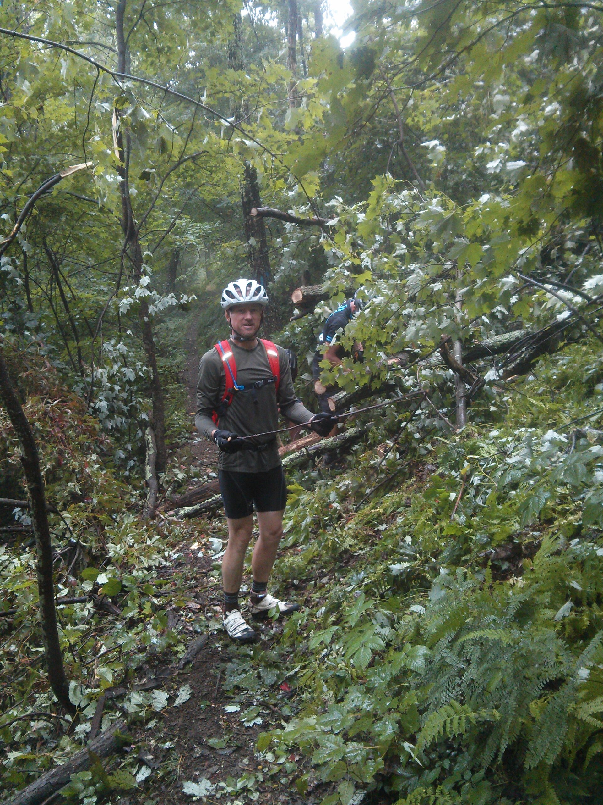
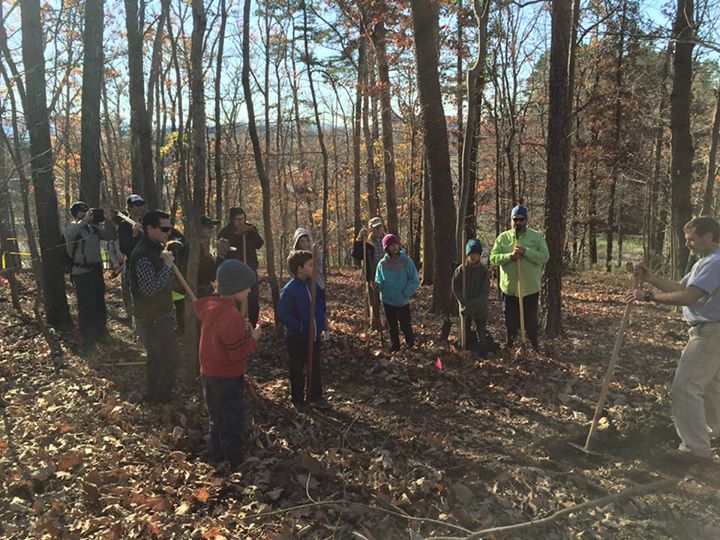
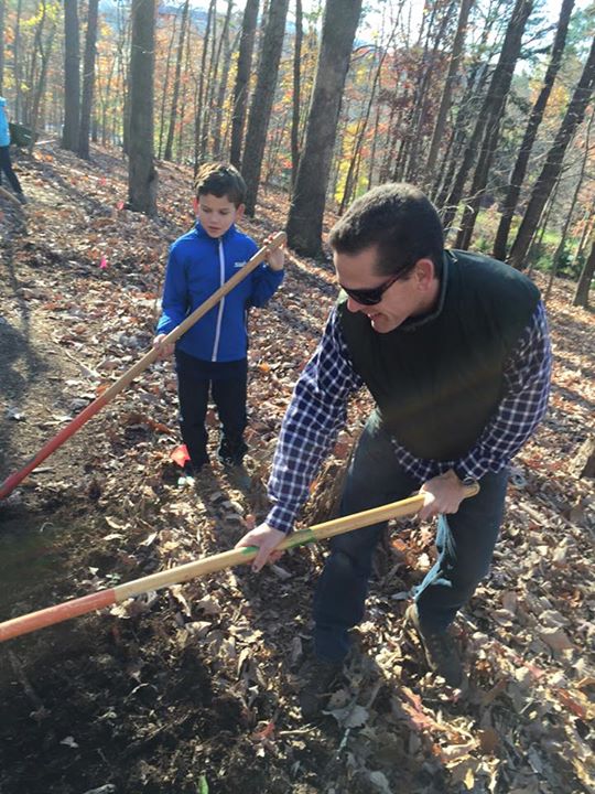
After the work site was properly prepared, motivated volunteers were invited. And we started early, 8 a.m. on a Saturday morning! Volunteers of all ages were trained on how to clear branches out of the way and created the new contour trail by benching the ground. Here, Jon C. is giving a tutorial on how to build trail.

C:\Users\jdh8d\Desktop\2015Nov14_Trailwork\11693924_1665352723749162_6767559675305660152_n.jpg


While another group gets started on some raking.

C:\Users\jdh8d\Desktop\2015Nov14_Trailwork\12208513_1665352610415840_2258081520304590967_n.jpg


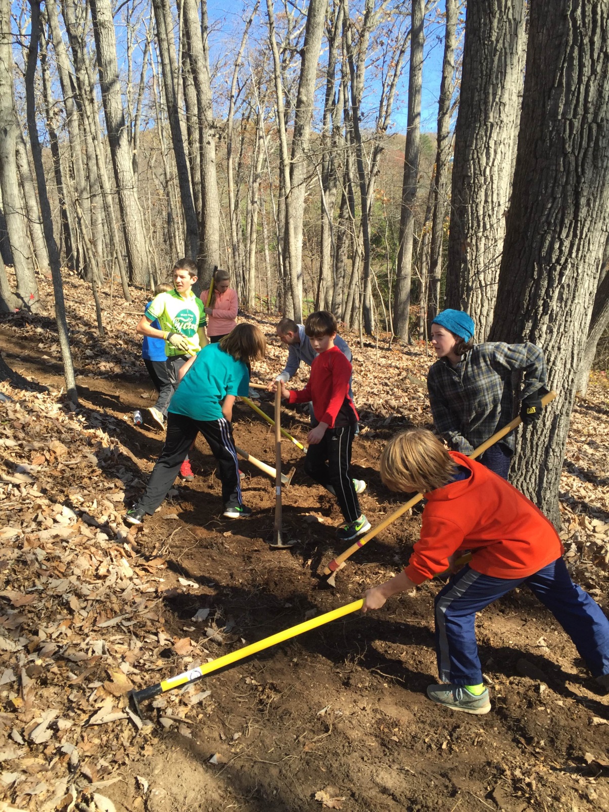
Benching is the process of creating a trail tread that is both pleasant to walk on, but still shaped so that water can flow off the trail with minimal erosion. Here the kids are putting to use what they learned on how to create benched trail.

C:\Users\jdh8d\Desktop\2015Nov14_Trailwork\IMG_1795.JPG

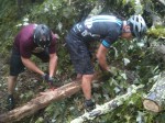
Another group of volunteers also had to create a properly shaped switch back turn. It involved starting with moving a lot of local rock to form a firm foundation so that the turn would maintain its shape for centuries.

C:\Users\jdh8d\Desktop\2015Nov14_Trailwork\IMG_6558.JPG

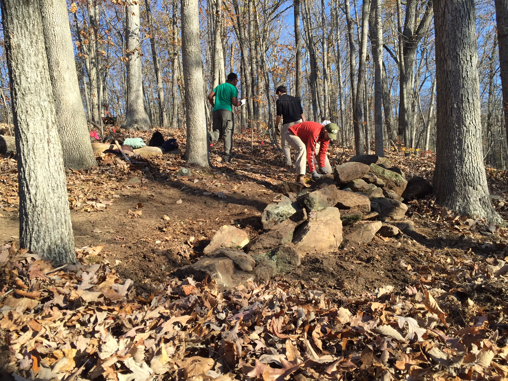
Then using dirt removed during the benching process for other parts of the trail to form a trail tread in the turn. The final product is beautiful and does not adequately portray the amount of skill and “sweat equity” involved. Building turns is super hard work, and this crew is justifiably proud of their effort!

C:\Users\jdh8d\Desktop\2015Nov14_Trailwork\20151114_114833-1_resized.jpg

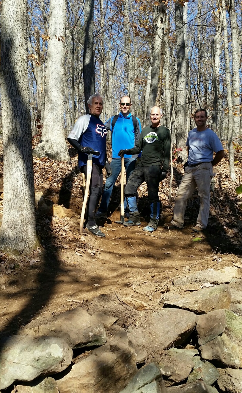
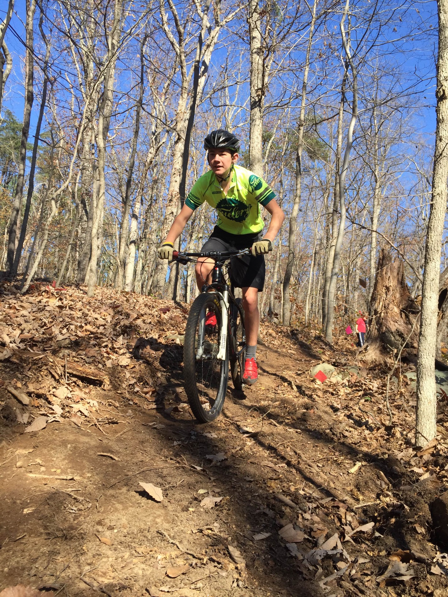
Of course, we had to test that the trail would meet the need of being pleasant to users.

C:\Users\jdh8d\Desktop\2015Nov14_Trailwork\IMG_1797.JPG
Another important aspect of re-routing trail is closure of the old trail. Many people think it’s simply piling some sticks or rocks at the entrance to the old trail, or maybe putting up a sign. That’s not good enough, because some users may still want to use the old trail and might reopen the old trail. Further, that does nothing to control the erosion issue on the old trail.

To solve these issues volunteers started by using hand tools to break up the tread on the trail to be closed so that new vegetation can grow.

C:\Users\jdh8d\Desktop\2015Nov14_Trailwork\10404454_1665352707082497_7557101082003884731_n.jpg

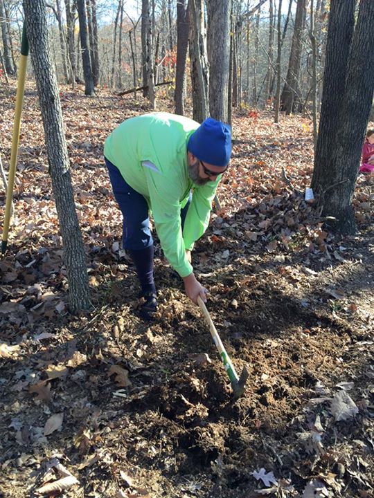
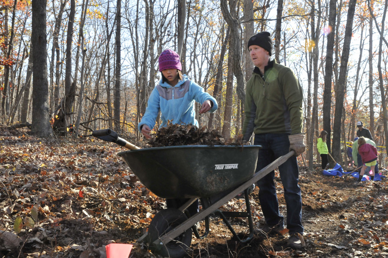
Without this step, the old trail tread is too compacted for plants to get a foothold. New plants are the key to erosion control. Then we brought in organic material (dead trees, leaves, grass roots) from the new trail construction part of the project to disguise the old trail.

C:\Users\jdh8d\Desktop\2015Nov14_Trailwork\trails 20151114005em.jpg

We also transplanted small trees into the trail to close the “line of sight” so that trail users do not experience the opened corridor as a possible alternate route to use. At the end of the process, the goal is to have the closed trail appear as if there was never a trail there.

Big thanks to the students and community members who participated! We had members of CAMBC, RTF, the Cutaway Mountain Bike Team, the CRC/BRC Mountain Bike Team, UVA Outdoors Club, UVA Cycling, and UVA’s Madison House totaling over 60 people and over 220 volunteer hours!

Unfortunately, the ¼ mile of trenched trail was more than could be closed by hand and volunteers were only able to close the most dangerous section on this workday. CAMBC is in the process of planning a follow up work day to close the rest of the eroded sections.

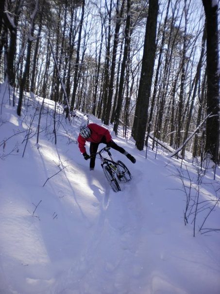
If you aren’t a member of CAMBC or RTF, please consider joining. Your support helps your local trails look like this.

Categories
Ride Reports: SERS

SERS: Sherando (Pocahontas rained out)

Virginia weather can be unpredictable.  Mid August, and it’s 78f and overcast outside.  And, it’s raining in Charlottesville and Richmond.  So, our intended ride (Pocahontis State Park) wasn’t going to work.  Time for a new plan.

Of course, everyone wanted to know if we’d be rained out.  Well, the rain in Charlottesville and Richmond came from the north west, and was headed south-east.  It seemed like it would miss Sherando completely.  So, at 7:30am with the rain getting heavier, we take off down the highway.  And it keeps raining, and as we approach Afton the fog and rain set in.  But!  The second we hit the valley, the rain abruptly ends, riding shall happen!

We roll into Sherando’s Turkey Pen
parking area to an almost dry road, but very low skies.  So, we quickly get ready and roll up Mill’s Creek trail and the infamous Sherando switchbacks, heading for Torry Ridge.  The first mile of torry’s moist rocks reminds us that it’s not a great day for such shenanigans.  To drive the point home, a lonely thorn decides to claim one of Rob’s tubes, so we take a quick food, and water break, and fix the issue before heading down Slacks trail.  Enjoying the flow is short lived as a downed tree halts our progress.  The saws come out, and the tree is gone, while I “supervise” by drinking a bit more water.

Since the day is turning out to be stellar, we decided some more climbing is in order and head up White Rock trail to the parkway, up the parkway, and back to the switchbacks and Mills Creek.  Unfortunately, mother nature wasn’t going to be thwarted quite so easily, and decided to up the fog level to “ultra heavy”, decided rain was still in order.  Luckily, the rain was short lived and we were already moist from riding in the heavy fog anyhow, and it was plenty warm enough, so no one really seemed to care.

The rest of the ride was pretty uneventful, and we ripped our way downhill to the cars, got cleaned up, and decided beer and burgers were in order at Blue Mountain Brewery.  Not bad for a rainy day in town. 🙂


[sgpx gpx=”/wp-content/uploads/gpx/Sherando08232014.gpx”]